The water around Vlorë is so clear because several processes work together: pale stone and sand reflect sunlight back through shallow water, seagrass meadows help hold sediment in place, and exchange through the Strait of Otranto keeps the bay connected to the open sea. Clarity shifts with light, wind and weather, and it describes transparency, not water quality.
There is a moment that almost every visitor to the Bay of Vlora experiences. It may come while standing above the rocky coastline of Uji i Ftohtë, leaning over the side of a boat near Karaburun or swimming above the pale stones of a small beach. The seabed appears so close that reaching it seems effortless. Yet when someone dives towards it, the distance is often much greater than expected.
The water has removed the usual barrier between the eye and the landscape beneath it: boats appear to float above their own shadows, and fish seem suspended between the surface and the stones. Science begins with a simpler question: why is the water here so clear, and why can its colour change so dramatically within the same bay?
Why the seabed looks closer than it is
Asked what surprised them most, very few people snorkelling in the Bay of Vlora for the first time mention fish. Most say the same thing: “I couldn’t believe how far away the bottom actually was.”
Clear water quietly confuses the brain. Normally, tiny suspended particles soften outlines and gradually hide the seabed as depth increases, and the eye uses that fading to judge distance. Here those clues almost disappear: rocks stay sharp, shadows stay dark, and a boat at anchor seems to hang above its own shadow. Light adds a second illusion. As it passes from air into water it bends, so objects beneath the surface appear roughly 25 per cent closer than they really are. The seabed seems close enough to touch; only a dive shows that it is still several metres below.
Why does the sea turn turquoise?
Water does not possess one permanent colour. What a visitor sees depends on depth, sunlight, weather, the material covering the seabed and the particles suspended in the water.
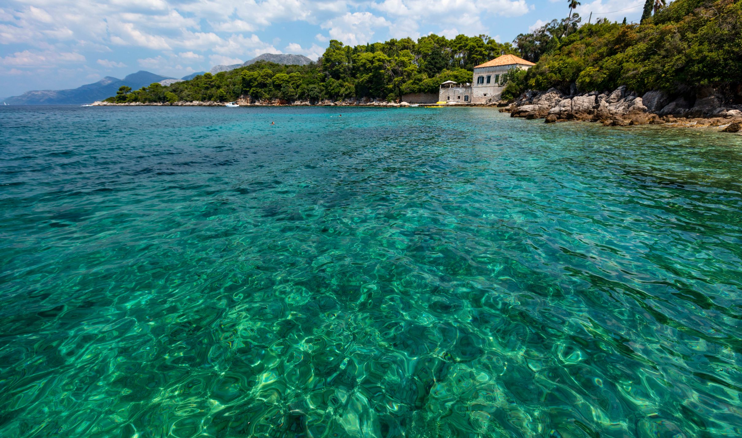
In shallow, transparent areas, sunlight reaches pale stones or sand and reflects upwards, producing the brilliant turquoise associated with Karaburun, Sazan and much of the Albanian Riviera. As the seabed becomes deeper, less light returns from below and the colour changes gradually into a darker Mediterranean blue. The first key to the bay’s famous water is therefore surprisingly simple: much of the turquoise admired from above is the seabed shining back through the water.
The bay can change colour several times in a single day. Early in the morning, when sunlight reaches the surface at a low angle, the water may appear silver or pale blue. By midday, shallow areas begin to glow turquoise while deeper sections turn an intense sapphire. Near sunset, the same sea reflects gold, red and violet from the sky, temporarily masking an underwater landscape that was visible only hours earlier.
Wind changes the view as well. After a calm night, suspended particles gradually settle and underwater visibility may improve. Stronger waves can lift fine material from the seabed and make the same beach appear less transparent the following morning.
Clarity is a living condition, shaped by light, weather and the character of each section of coastline. The bay has a language of blues, and every shade reveals something about depth, seabed and exposure to the open sea.
When is the water clearest?
The clearest water usually comes early in the morning, after several calm days and before the afternoon breeze ripples the surface. Without strong wind, fine particles sink back to the seabed, colours brighten and every stone can cast a sharp shadow. Fishermen in Triport, Radhimë and Orikum read these conditions from the wind rather than from an app: “The sea will be like glass tomorrow” is still a forecast heard along the coast after a run of still nights. Clear water changes life beneath the surface too: fish can see further, become more cautious, and fishermen adapt their techniques accordingly.
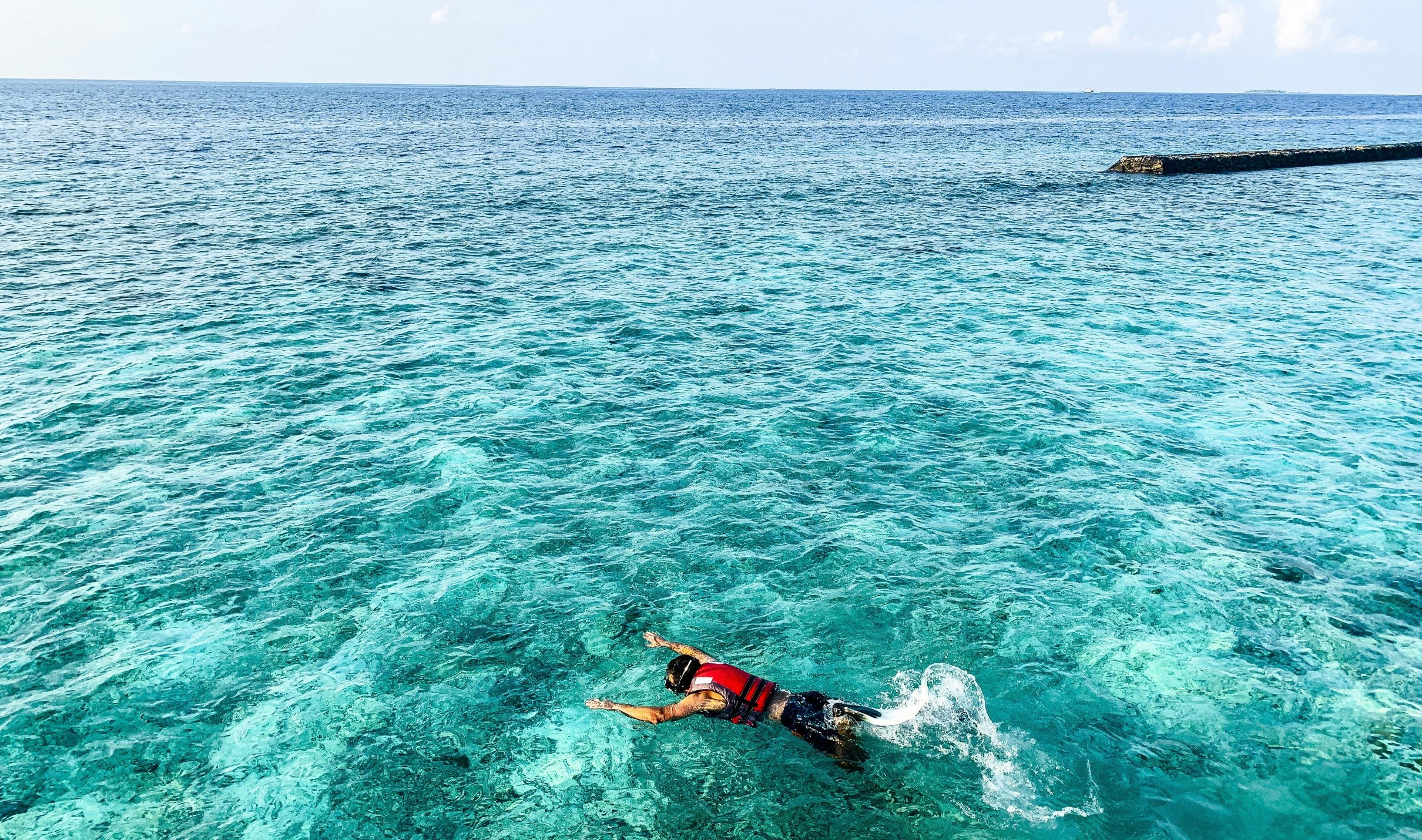
For a swimmer, the advice is simple: go early, choose a sheltered rocky stretch such as Uji i Ftohtë or Radhimë, and take a mask. Children often find their own way to measure the day’s clarity, dropping a small white pebble and competing to follow it longest before it vanishes into the blue. On the clearest mornings, the game lasts surprisingly long.
Clear water is not empty water
People often look into exceptionally transparent water and assume that almost nothing lives in it. The stones are visible, the space between them appears empty and only an occasional fish interrupts the stillness. It is one of the greatest illusions created by the sea.
Scientific research in the Bay of Vlora has recorded hundreds of types of phytoplankton and microzooplankton. These organisms are so small that a swimmer can pass through an entire living community without noticing a single member of it. Some capture sunlight and help form the beginning of marine food webs; others transfer that energy towards larger organisms. The apparently empty space between a swimmer and the seabed is filled with biological activity, much of it too small, too quiet or too well concealed to interrupt the passage of light.
A snorkeller begins to understand this within minutes. What looked from the shore like an empty blue surface becomes a landscape of small fish moving between rocks, molluscs attached to stone, algae following the movement of the water and shadows disappearing into narrow openings. Pale stones gradually give way to sand, sand to vegetation, and the vegetation finally opens towards deeper blue.
Clarity, however, should not automatically be treated as proof of perfect water quality. Some chemical or microbiological conditions cannot be judged by sight alone. Transparency describes how easily light passes through the water; environmental quality requires scientific monitoring. The human eye can admire clarity, but it cannot perform the work of a laboratory.
The dark patches beneath the blue
Visitors sometimes become concerned when they notice large dark patches beneath otherwise turquoise water. From a distance, these areas can resemble deep holes, rocks or shadows from passing clouds. In many places, however, they reveal something far more valuable: underwater habitats formed by Mediterranean seagrass and other marine vegetation.
A snorkeller passing from pale stones into one of these darker areas immediately feels that the landscape has changed. Small fish find shelter between the leaves, fragments of sunlight move across the vegetation and the open seabed becomes a layered habitat. What looked from the boat like a simple change in colour is the boundary between two different underwater worlds.
The meadows also influence the water around them. Their leaves slow water movement close to the bottom, while their roots and rhizomes help hold sediment in place, making it more difficult for every small wave to lift loose particles back into the water.
The relationship runs in both directions. Seagrass needs sunlight to survive, so it benefits from transparent water; once established, the meadow helps stabilise sediment and can contribute to the conditions that allow light to keep reaching it. Clear water supports the meadow, and the meadow helps the water remain clear: the dark shapes beneath the blue are part of the living system that helps to create it.
A bay with an open door
From the city, the Bay of Vlora appears almost enclosed. The Karaburun Peninsula forms its western wall, the coastline curves around its eastern and southern sides, and Sazan Island stands near the entrance like a natural guardian. This geography creates the impression of a protected marine room, separated from the greater Mediterranean beyond it.
In reality, the door is always open. The bay lies beside the Strait of Otranto, the passage connecting the Adriatic and Ionian Seas. Water, heat, salt, oxygen and biological material move through this gateway as part of a much larger regional circulation, so the sea touching the coast of Vlorë belongs to an interconnected system extending through the southern Adriatic, the Ionian and the wider Mediterranean.
Different masses of water can move in different directions and at different depths. Ionian water generally travels northwards along the eastern side of the strait, while Adriatic water returns southwards through other sections and deeper layers. What appears on a map as a narrow line between two seas is a multilayered marine junction.
None of this means that all the water inside the Bay of Vlora is replaced immediately, or that one invisible current continuously washes every beach. Local circulation is also influenced by wind, waves, depth, temperature and the shape of the coastline. The bay is protected without being isolated: the horizon may look like its end, but for the water it is only another passage.
A calm surface can hide a moving sea
On a quiet summer morning, the Bay of Vlora can resemble an enormous mirror. The surface appears almost motionless, reflecting Karaburun, Sazan and the surrounding coastline with barely a disturbance.
Beneath it, water continues to move under the influence of wind, temperature, density and the shape of the seabed. Some of this movement is regional and connected to the exchange through the Strait of Otranto. Other circulation is local, created by winds crossing the bay and by the natural shelter of the peninsula.
Different sections can therefore behave differently on the same day. A beach near the city may remain calm while another part of the coastline experiences stronger waves or reduced visibility. People familiar with the bay rarely judge the entire sea by looking at one beach: they know that Uji i Ftohtë, Radhimë, Orikum, Sazan and Karaburun do not always experience the same conditions.
The direction of the wind may leave one cove protected while exposing another, and a change that appears sudden from the shore may have begun hours earlier over the open sea. Much of the beauty of the bay is created by movement rather than stillness.
Summer above, spring below
One of the most surprising sensations for a swimmer comes during the warmer months. The surface feels almost like a bath, but a few strokes downward suddenly reveal a colder layer. The change can be sharp enough to feel like crossing an invisible boundary.
That boundary is real. During spring and summer, sunlight warms the surface more rapidly than the deeper water, and the warmer layer becomes lighter and remains above colder, denser water. This seasonal separation is known as thermal stratification. At the surface, summer has already arrived; several metres below, the water can still carry the cool memory of spring.
The separation influences more than the comfort of swimmers. It affects the distribution of oxygen, nutrients and microscopic organisms through the water. Later in the year, cooler temperatures and stronger winds weaken the difference between the layers, the water mixes more deeply and the internal structure of the bay changes again.
Visitors notice the seasons through air temperature and sunlight. Marine life experiences them as a reorganisation of the entire water column.
One bay, several underwater worlds
Seen from the hills above Vlorë, the bay appears to be one coherent marine space. Scientific research reveals important differences between its inner, intermediate and outer areas.
The inner section is more strongly influenced by the city, ports, lagoons and material arriving from land. The outer bay is more directly connected with open marine conditions near Karaburun, Sazan and the entrance towards the Strait of Otranto. Between them lies a changing transition zone where the characteristics of both environments meet.
A boat can pass between these ecological worlds without crossing any visible line. A swimmer cannot feel the exact moment one area becomes another, yet microscopic organisms respond to differences in temperature, circulation and available nutrients. The biological map of the bay has no roads or borders, and the water itself continuously redraws it.
This helps explain why a sheltered city beach, a rocky swimming place near Uji i Ftohtë and an exposed cove around Karaburun can feel so different despite belonging to the same bay.
What do storms do to the water’s clarity?
A summer storm can temporarily erase the transparency that visitors associate with Vlorë. Waves strike the coastline, sediment rises from the seabed and the water near exposed beaches becomes cloudy. At first glance this seems a simple loss of clarity; in reality, the sea is being physically reorganised.
Wave energy moves sediment, breaks down the warm surface layer and mixes water that had remained separated during calm periods. Material resting on the seabed may return to circulation, while nutrients can be moved into parts of the water where microscopic organisms can use them.
After the storm passes, heavier particles begin to settle and sheltered areas calm more quickly. Underwater visibility gradually returns, and the bay reaches a new temporary balance, different from the one before. This is why the sea can look different every morning: almost transparent one day, deeper in colour, cooler or less clear the next.
These changes do not mean the bay is unstable. They mean it is alive. A calm sea is a sea whose work has become invisible.
The richest seabed is not always the brightest
Clarity changes the relationship between people and the sea. In cloudy water, the surface becomes a visual boundary; in transparent water, that boundary weakens, and a swimmer can follow the movement of fish and recognise the point where pale seabed gives way to a darker meadow. Snorkelling near Uji i Ftohtë, Karaburun or Sazan reveals landscapes almost invisible to someone travelling only by road: a small cove continues underwater through rocky ledges, vegetation, patches of sand and narrow spaces used by marine life.
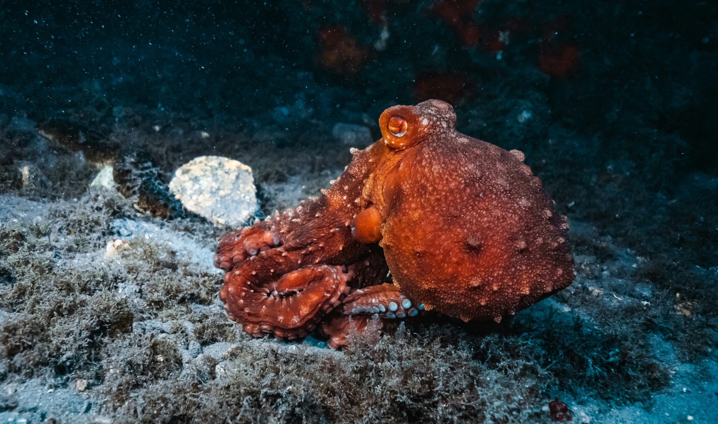
The experience is often intimate rather than spectacular. It may be a small octopus withdrawing between rocks, a school of fish changing direction together or sunlight moving across the leaves of seagrass. Moments like these turn the underwater landscape from an abstract ecosystem into part of a personal memory.
Pale sand and white stones produce the brightest turquoise water, which makes them particularly attractive in photographs. Yet the darkest parts of the seabed are often the most complex biologically. A seagrass meadow can provide shelter, nursery habitat and feeding space for organisms that would find little protection over bare sediment, and it may support more life than the bright seabed beside it.
The meadow’s importance lies in the relationships it sustains below the surface, whatever it looks like from a boat; the sea does not organise its richest habitats according to human ideas of visual perfection. Understanding this changes the experience of snorkelling. A dark patch stops looking like something to avoid and becomes an invitation to observe from a respectful distance, because the change in colour signals that the underwater landscape has become more complex.
What can disappear before anyone notices
The greatest danger facing underwater habitats is that their decline may remain almost invisible from land. A road, hotel or restaurant can continue overlooking the same blue horizon even after the ecosystem below has begun to change.
Research in the Bay of Vlora has documented historical losses of seagrass and other habitat-forming vegetation associated with rapid and poorly planned coastal development. This is one of the most sobering lessons of the bay: a coastline can remain beautiful in photographs while losing some of the living structures that helped create that beauty.
Seagrass grows slowly compared with the speed at which construction, pollution, repeated anchoring or seabed disturbance can damage it. Once a meadow becomes fragmented, the sediment it held in place becomes more exposed and the habitat loses continuity. The damage may begin with scars too small to notice from a boat, but repeated disturbance can gradually transform an entire underwater landscape.
What cannot be seen from the shore can still determine what the shore will look like in the future.
Protecting the water beneath the view
Protecting the crystal waters of the Bay of Vlora therefore means protecting more than the appearance of the surface. It requires care for the habitats below, for the quality of the water entering the bay and for the way tourism, infrastructure and boating interact with the marine environment.
The Karaburun–Sazan National Marine Park – in Albanian, Parku Kombëtar Detar Karaburun-Sazan – protects the most dramatic marine landscape connected with the bay. Around the peninsula and Sazan Island, rocky coastlines, caves, underwater habitats and open-sea conditions meet near the boundary between the Adriatic and Ionian Seas.
The purpose of a marine protected area is to allow nature, local communities and responsible tourism to continue existing together without destroying the system on which they all depend. Protection benefits more than rare species: it safeguards swimming water, living seabeds, fishing traditions and the boat journeys that define a visit to Vlorë. Conservation is the work that allows tourism to continue without consuming the landscape that created it.
The future of the bay will be shaped by thousands of decisions made by institutions, businesses, residents and visitors. Some concern major infrastructure and water management; others appear much smaller, such as where a boat drops its anchor or whether rubbish is left behind in an isolated cove.
Anchoring directly over a seagrass meadow can break leaves and damage the underground structures holding the plant and sediment together, and repeated anchoring creates scars, particularly in popular coves where many vessels stop in the same places. Visitors can also help by observing marine animals without removing them: a shell, starfish or small creature may look like a souvenir, but it belongs to a living system. Responsible tourism makes the experience more meaningful, and no less enjoyable.
Seeing Vlorë’s water differently
Once the processes behind the bay’s clarity are understood, the familiar view begins to change. Turquoise near a shallow beach becomes sunlight returning from the seabed, a dark patch beneath a boat becomes habitat, and a sudden cold layer reveals that summer may exist only at the surface. Even the horizon acquires a different meaning: what appears to be the edge of the bay is the entrance to a circulation connecting the Adriatic and Ionian Seas.
A visitor does not need to remember the scientific name of every plant or understand every current. It is enough to leave with a more accurate sense of what has been experienced: the Bay of Vlora is a living environment whose colour, clarity and biodiversity depend on relationships that continue every hour of the day.
What lies behind the crystal waters of the Bay of Vlora is not one spring, one current or one beach. It is the balance created when sunlight, geology, open-sea exchange, local circulation, underwater vegetation and microscopic life continue working together. The bay appears peaceful because most of that work is invisible, empty because much of its life is microscopic or out of sight, and permanent because environmental change often begins beneath the surface, long before it becomes obvious from shore. Its colour is only the beginning of what the bay allows a visitor to discover.
Experience the place
The clarity of the bay is best understood at water level: a swim above pale stones, a snorkel along the rocky coast of Uji i Ftohtë or a boat trip to the coves of Karaburun and Sazan. Valza Boutique Hotel stands in Uji i Ftohtë – literally “cold water”, a name linked to the freshwater springs along this coast – on the southern side of Vlorë, and our reception team helps guests choose and book boat trips to Sazan Island and the Karaburun Peninsula, with departures depending on sea and weather conditions. In the evening, Eden by Valza, on the hotel’s sixth-floor rooftop, looks across the whole bay with a 180-degree view.
This article is part of MAREOGRAPH, an independent editorial project created by Valza Boutique Hotel to document and explain the natural, historical and cultural heritage of the Bay of Vlora and the Albanian Mediterranean. Each article combines scientific research, historical context, local knowledge and human storytelling, to help readers understand what they are seeing and what should be protected as the coast continues to change.