The Bay of Vlora matters because geology, climate, marine life and human history reinforce one another here. Its limestone cliffs were once seabed, and 12,000 years ago the bay was still dry land, flooded as Ice Age glaciers melted. Today Karaburun shelters a natural harbour, the Strait of Otranto renews its water and the bay still shapes daily life.
Most visitors fall in love with the bay long before they understand it. They remember the brilliant blue water stretching towards Karaburun, the silhouette of Sazan Island on the horizon and sunsets that seem to linger a little longer than expected. Those memories explain why Gjiri i Vlorës, as the bay is called in Albanian, is beautiful. They do not explain why it has mattered, without interruption, for thousands of years.
The answer lies in a chain of connections. Mountains shaped the winds, the winds shaped the sea, and the sea determined where ships could anchor safely. Safe anchorages encouraged settlement, settlement encouraged trade, and trade turned a quiet bay into one of Albania’s defining landscapes. Once those links become visible, the beaches, the mountains and even the city of Vlorë begin to make sense: here, geography is never merely scenery.
When the bay was dry land
The story of the Bay of Vlora began long before there was a bay. The limestone cliffs that now overlook the water once formed part of the floor of an ancient tropical ocean, where countless marine organisms lived, died and slowly accumulated, layer upon layer. Over immense periods of time, the collision between the African and Eurasian tectonic plates compressed these sediments until they folded, fractured and rose high above sea level.
Every cliff above the bay is therefore the remains of a prehistoric seabed, lifted into the sky by geological forces that still shape the Mediterranean today. A walker on a viewpoint above the Bay of Vlora is standing on the floor of an ocean that disappeared millions of years before the first humans reached this coast.
The coastline itself is surprisingly young. During the last Ice Age, when vast quantities of the Earth’s water remained locked in glaciers, global sea levels were more than 100 metres lower than today. Instead of a broad bay, rivers crossed an open valley that extended far beyond the present shoreline. As the climate warmed and the glaciers melted, the Adriatic gradually advanced inland, flooding that landscape and turning it into the sheltered marine basin seen today.
Anyone standing here 12,000 years ago would not have seen the Bay of Vlora at all, only dry land.
Coastlines, in other words, are living landscapes, constantly rewritten by geology, climate and the sea. Geology alone, however, does not explain why this place became so important. For that, the story has to continue after nature finished building the landscape.
Why is the Bay of Vlora so calm?
The defining quality of the bay is its shape rather than its colour. The Karaburun Peninsula runs along its western side and separates the inner coastline from the more exposed water beyond. Outside this natural barrier, wind and waves arrive directly from the open Ionian; inside, much of that energy has already been interrupted, redirected or weakened.
A boat leaving the inner bay can meet visibly different conditions as soon as it passes beyond the protection of Karaburun. The distance is small, but the geography has changed, and the fishermen of Vlorë learned to read that change long before science explained it.
Why did ancient sailors stop here?
History often seems to be written by kings, armies and political decisions. Geography rarely receives the same attention, yet it decides which opportunities exist long before people recognise them, and few places in the Mediterranean show this as clearly as the Bay of Vlora.
Imagine a wooden sailing vessel approaching this coast 2,000 years ago. There is no engine, no weather forecast and no GPS on board: everything depends on the wind, the waves and the crew’s ability to find shelter before conditions change. Then the coastline opens. Ahead lies a broad natural bay protected by the long limestone ridge of the Karaburun Peninsula, where the water grows calmer and the waves lose much of their strength.
Freshwater can be found nearby, fertile valleys lie a short distance inland and the open gateway of the Strait of Otranto remains within easy reach. Without realising it, the crew has entered one of the safest natural harbours on the eastern Adriatic. For ancient sailors this shelter meant security, and sometimes the difference between continuing a journey and losing an entire ship.
That simple advantage shaped everything that followed. Ships stopped because they could; traders exchanged goods because ships stopped; settlements grew because trade created opportunity; and roads linked the coast with the interior because communities needed reliable access to the sea. None of this was planned: the landscape encouraged the same decisions, generation after generation.
Illyrians, Greeks, Romans, Byzantines, Venetians, Ottomans and modern Albanians all inherited the same coastline. They spoke different languages, worshipped different gods and built different societies, yet they all recognised the same natural advantages. Political power changed repeatedly, while the geography remained astonishingly constant.
Two ancient settlements show the logic clearly. Aulon grew where the modern city stands, at a point where the sea could support movement and exchange; further south, Orikos occupied another sheltered position near today’s Orikum, where ships could wait for the right wind before continuing towards the Strait of Otranto. Both grew because the value of the place was already written into the landscape.
The Bay of Vlora did not become important because history happened here. History happened here because the landscape kept making it possible.
A sea that never stands still
The Bay of Vlora is often described as the place where the Adriatic and Ionian Seas meet, and many visitors picture an invisible line separating one from the other. The reality is more dynamic. The two seas are constantly exchanging water through the Strait of Otranto, carrying different temperatures, salinity levels, nutrients and marine life between them. Invisible from the shore, this slow but continuous movement has shaped the bay every day for thousands of years.
Healthy seas depend on movement. Without circulation, oxygen levels fall, nutrients become unevenly distributed and marine ecosystems gradually weaken. The bay avoids this because natural water exchange keeps refreshing it, so every wave that reaches the shore belongs to a much larger Mediterranean system extending hundreds of kilometres beyond the horizon. This constant renewal helps explain why the water often appears exceptionally clear.
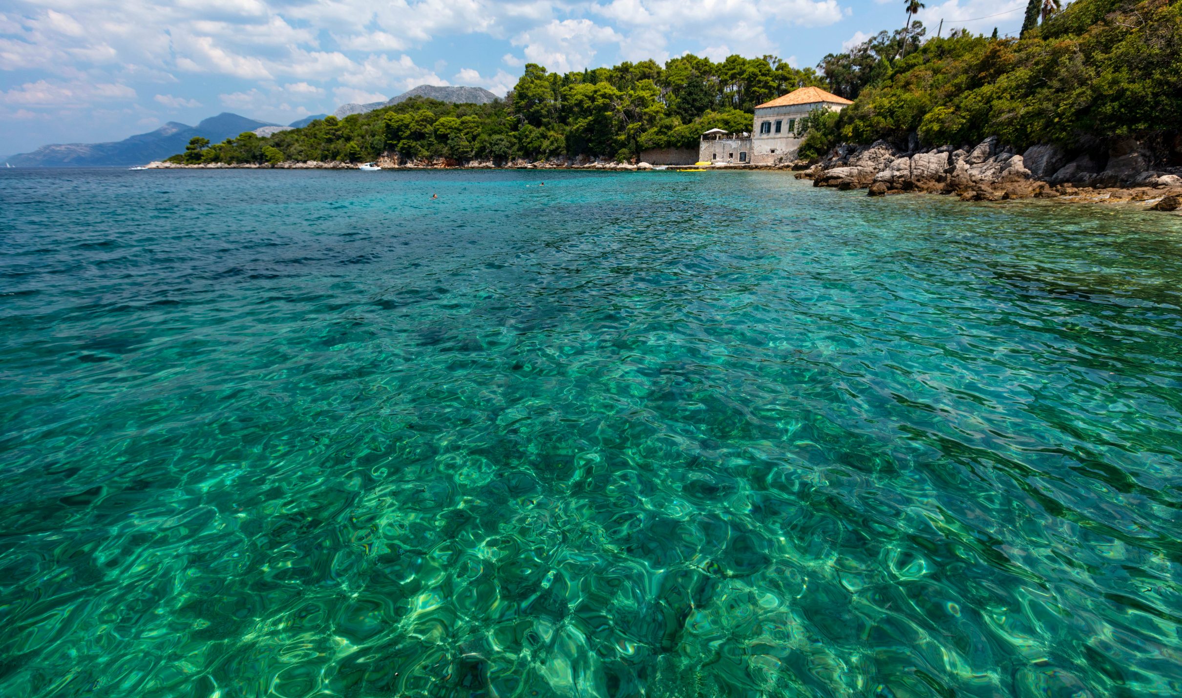
The colour of the sea changes too. Along the coast from the Old Beach towards Uji i Ftohtë and on to Radhimë, it shifts almost continuously. Above sandy seabeds it shows soft shades of blue; further south it turns turquoise where pale limestone and deeper water combine beneath the surface; by late afternoon the same coastline reflects darker sapphire tones as the angle of sunlight changes.
It can feel as though someone has replaced the sea during the drive. In reality the water is the same: what changes is the landscape beneath it, and the light that falls on it.
The life beneath the surface
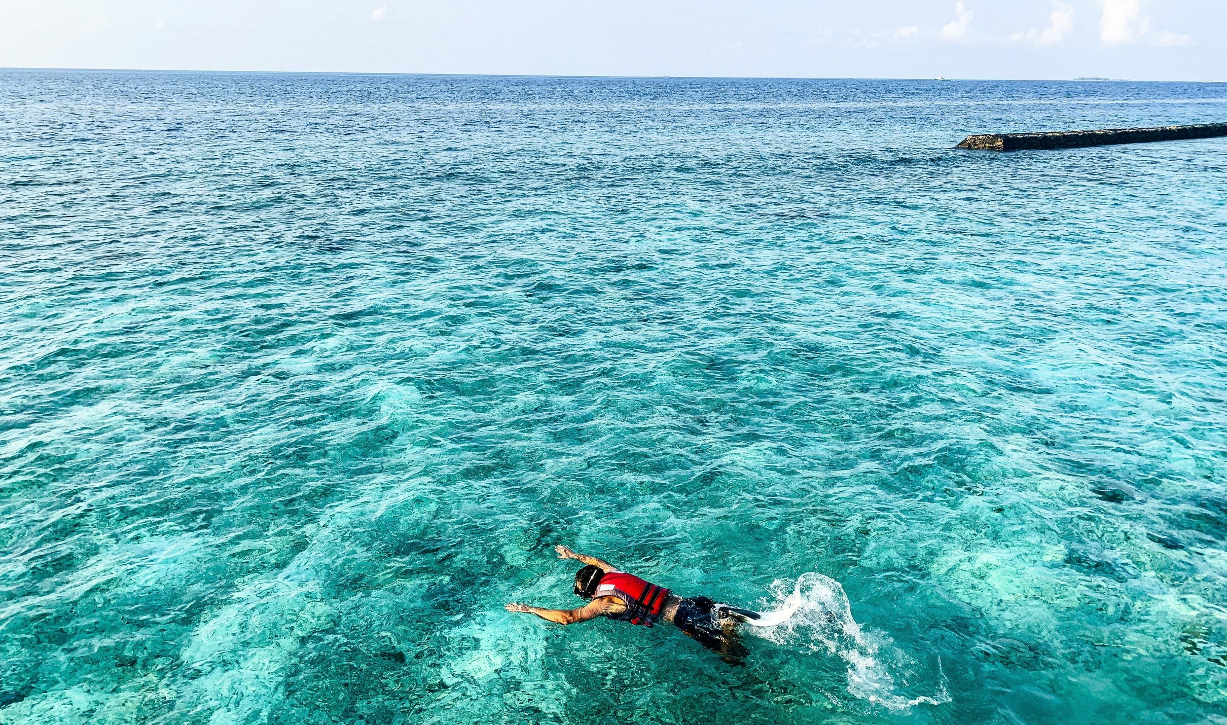
Most people spend the day looking across the Bay of Vlora; few remember to look into it. With nothing more than a simple snorkel mask, another landscape appears. Schools of silver fish move above underwater rocks, purple sea urchins anchor themselves in limestone crevices and colourful wrasse weave between patches of seagrass, while the scenery changes again every few metres.
Beneath the surface also grow meadows of Posidonia oceanica, a flowering marine plant found nowhere on Earth except in the Mediterranean Sea. The meadows stabilise the seabed, produce oxygen, shelter hundreds of marine species and store carbon; some have grown continuously for thousands of years. While people built cities, fought wars and changed civilisations above the surface, these underwater landscapes kept growing leaf by leaf. Perhaps the oldest living archive of the bay was never carved into stone, but grew beneath the sea.
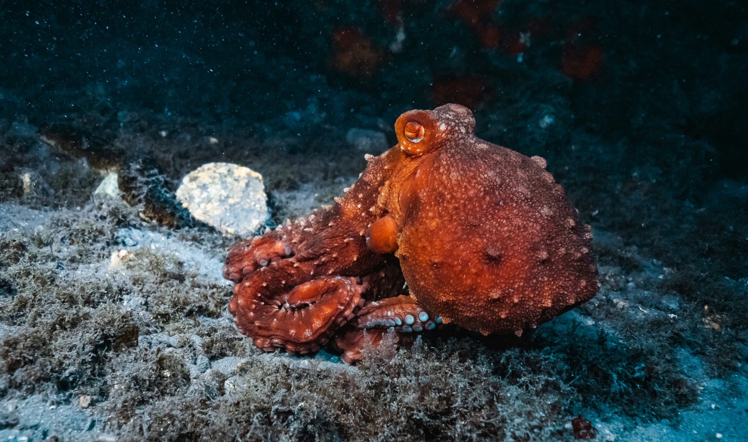
The rocky shore around Uji i Ftohtë holds another clue. Swimming slowly between the limestone outcrops, you may notice a small pile of broken shells beside a narrow crack in the rocks; it looks almost deliberate, and it usually is. Experienced divers read it as a sign that an octopus may be living inside, because these intelligent animals often leave the remains of shellfish and crabs outside their shelters after feeding.
The shells do not guarantee a sighting. But if you wait patiently and stay still, sometimes a curious eye appears first, followed by slowly unfolding arms as the animal cautiously investigates its visitor. Moments like these rarely appear in holiday brochures, yet they are often what people remember long after the holiday ends. They cannot be scheduled: they happen when curiosity replaces hurry.
The bay in another form: the Narta Lagoon
The bay does not end where open water meets its northern shore. Around the Narta Lagoon – Laguna e Nartës – the sea continues in a quieter form, where salinity changes, sediment settles and the boundary between land and water becomes uncertain. Birds feed and rest in the shallows, fish move between lagoon and sea, and vegetation holds ground the water keeps reclaiming. A bay’s health depends not only on its deepest water but on the places where land and sea are allowed to meet gradually, as the flamingos and sea turtles of Narta and Zvërnec show.
How does the bay make its own climate?
Some landscapes simply experience the weather. The Bay of Vlora helps to create its own, and the difference becomes obvious on a summer day spent travelling from the city towards Radhimë. Somewhere along the way the air changes: the heat softens, a gentle breeze arrives from the sea, and even on the warmest afternoons the coast often feels fresher than streets only a few kilometres inland.
This is no coincidence. The surrounding mountains, the open bay and the vast surface of the Adriatic work together every day, creating a natural rhythm that has influenced life here for centuries. In summer the land heats much faster than the sea, drawing cooler marine air inland. By evening, as the sun sinks behind the Karaburun Peninsula, the whole coastline seems to breathe more slowly.
The local fishermen – in Albanian, peshkatarët – have trusted these winds for generations. Long before weather apps existed, they knew when the afternoon breeze would arrive, when the sea would calm again and which mornings would offer the clearest conditions for heading offshore. For them, the landscape itself was the forecast.
The quality of the light
The same marine air explains something many visitors notice without knowing why: the quality of the light. Photographers often describe the Bay of Vlora as one of the easiest places in Albania to photograph, and the explanation lies in the air itself. Marine air usually contains fewer dust particles than inland air, allowing sunlight to travel with exceptional clarity.
Combined with pale limestone, open water and the changing position of the sun, that clarity produces a coastline whose colours never stay the same for long. A photographer who returns to the same viewpoint in the morning, at midday and again at sunset can feel they have visited three different places.
How the bay still shapes daily life
It is easy to believe that the Bay of Vlora mattered only in the past. Ancient sailors depended on it, Roman merchants used it and empires fought to control it, but geography did not stop working when history moved on. Today the bay continues to shape everyday life in ways so familiar that residents hardly notice them.
Fishing boats still leave before sunrise, because calmer morning water makes both navigation and fishing easier. Restaurants serve seafood that arrived only hours earlier, because productive marine ecosystems remain close to shore. Olive groves still climb the surrounding hills for the same reason they have for centuries: this landscape offers one of the Mediterranean’s most favourable combinations of sunlight, drainage and climate.
Even tourism follows geography. Families gravitate towards the broad sandy beaches of the north, snorkellers head south to rocky shores where underwater visibility is greatest, sailors choose Orikum, hikers climb Karaburun and photographers wait for sunset above the bay. Without realising it, modern visitors repeat many of the geographical choices that earlier generations made for entirely different reasons. Only the purpose has changed; the landscape has not.
What the bay explains
Every generation has discovered the Bay of Vlora in its own way. Ancient sailors found shelter, merchants found opportunity, scientists found a natural laboratory and travellers found beauty. Knowingly or not, all of them were responding to the same thing: a landscape whose greatest strength has always been the relationships it creates.
Seen this way, a single view from above the coast holds the whole story. The mountains once lay beneath a prehistoric sea. The water below is constantly renewed by one of the Mediterranean’s great marine circulation systems, the transparent shallows conceal underwater forests older than many civilisations, and the calm harbour that welcomes pleasure boats today once offered safety to ancient sailors crossing the Adriatic. The octopus beneath a nearby rock, the shell at the water’s edge and the afternoon breeze cooling the coast all belong to the same story.
The Bay of Vlora is not defined by one famous beach, one historic monument or one spectacular viewpoint. Its identity emerges from the way mountains, sea, climate, wildlife and people have shaped one another: for millions of years geology prepared this coastline, and for thousands of years people learned to live with it rather than against it. That is why the bay matters beyond its beauty. It is the landscape that explains why the Albanian Mediterranean exists as it does today.
Experience the place
The bay is best understood through its many faces: sunrise over the calm northern beaches, snorkelling among the limestone rocks of Uji i Ftohtë, the coves of Karaburun and, at the end of the day, the sun disappearing beyond the Strait of Otranto. Valza Boutique Hotel stands in Uji i Ftohtë – literally “cold water” – on the southern side of Vlorë, and our reception team helps guests choose and book boat trips to Sazan Island and the Karaburun Peninsula, with departures depending on sea and weather conditions. In the evening, Eden by Valza, on the hotel’s sixth-floor rooftop, serves modern Albanian and Mediterranean cuisine with a 180-degree view of the bay.
This article is part of MAREOGRAPH, an independent editorial project created by Valza Boutique Hotel to document and explain the natural, historical and cultural heritage of the Bay of Vlora and the Albanian Mediterranean. Each article combines scientific research, historical context, local knowledge and human storytelling, to help readers understand what they are seeing and what should be protected as the coast continues to change.