A steep path from the mountains to the sea, on the coast where Caesar is said to have landed his army.
The Julius Caesar Trail is a marked but not heavily maintained path that drops about 950 metres down the steep Ionian face of the Ceraunian Mountains, from near the Llogara Pass to the bay of Palasë. It takes several hours, is moderate to hard, and suits experienced walkers and history lovers.
A walk down into the year 48 BC
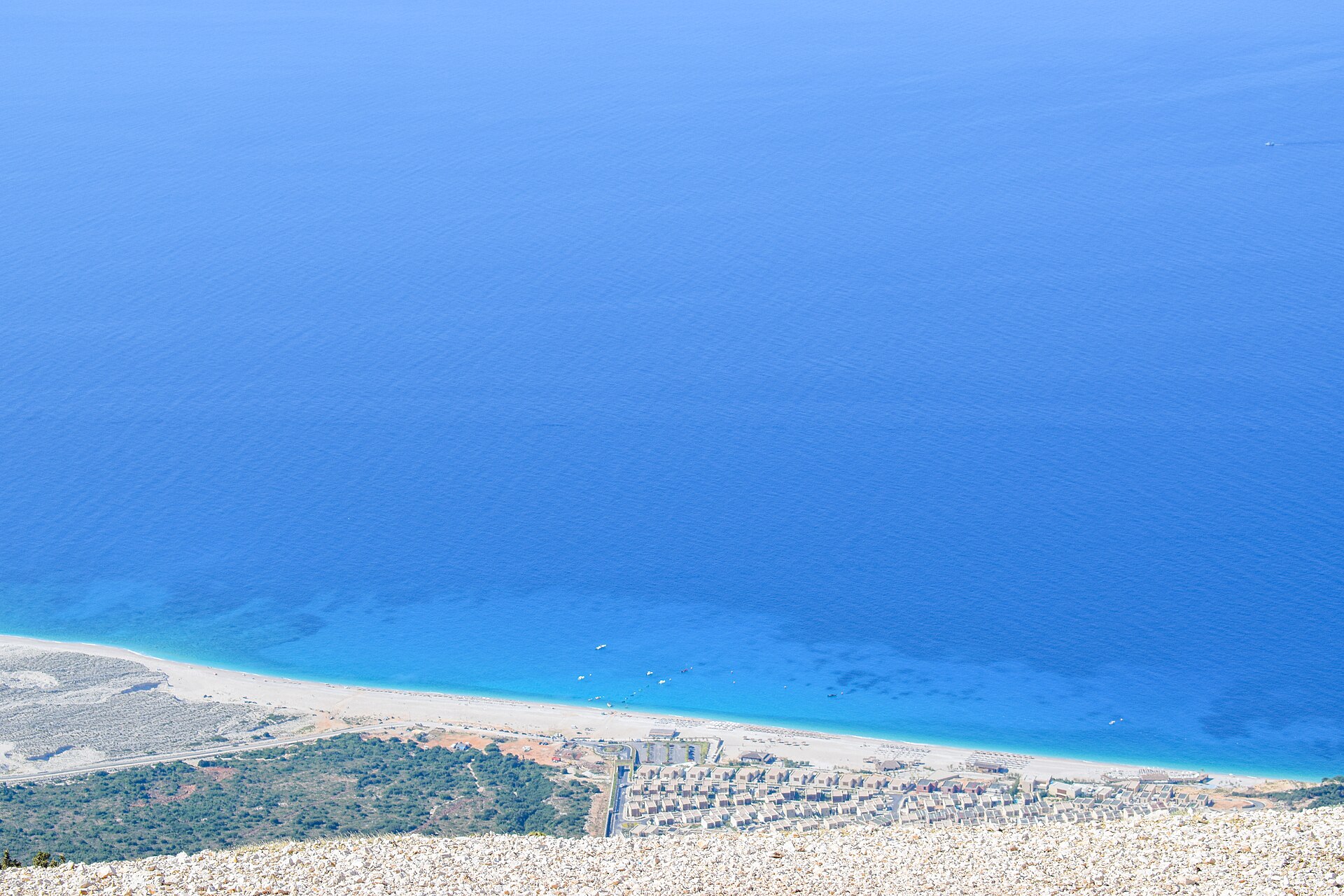
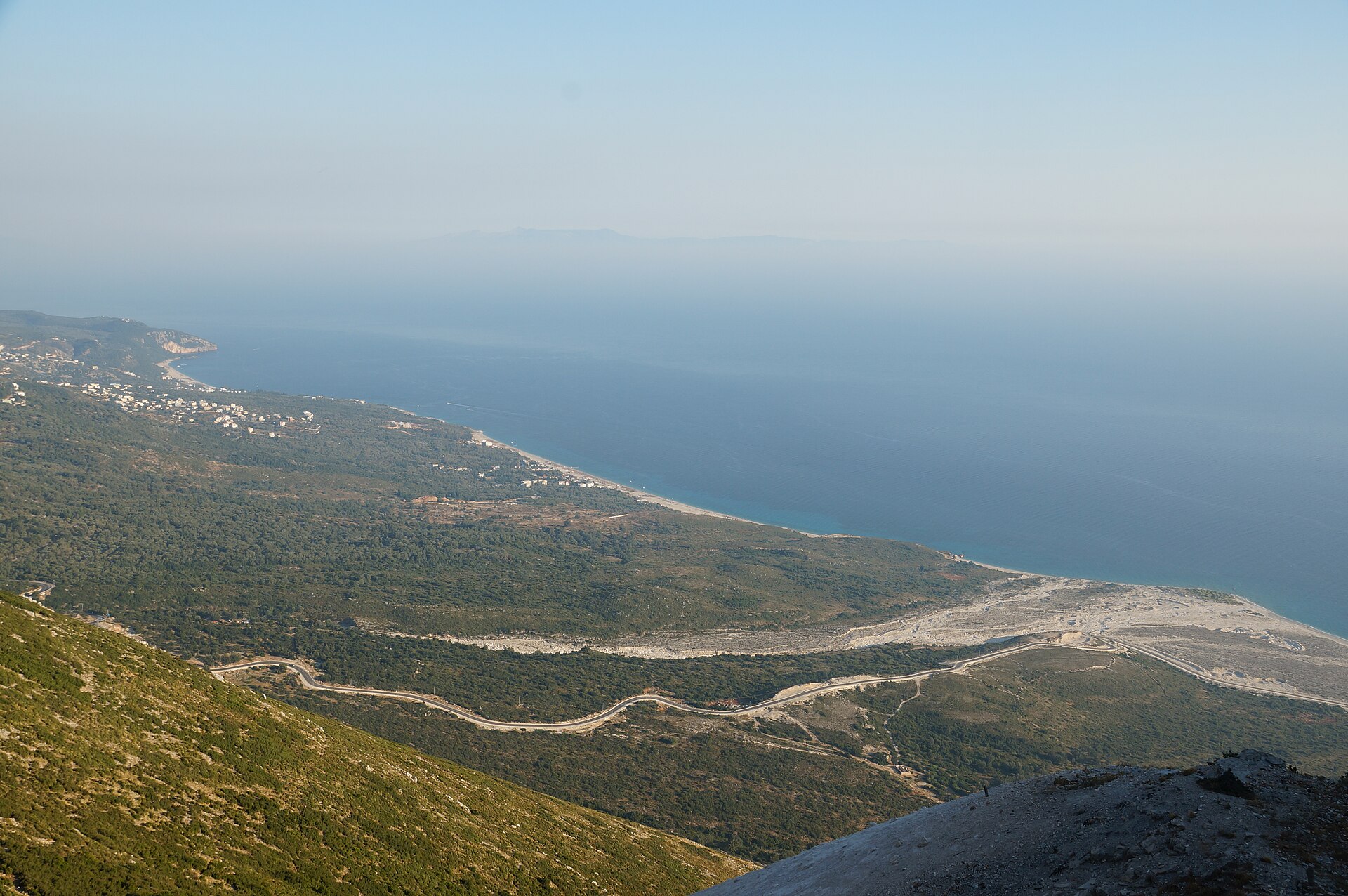
Stand at the top of this trail, near the Llogara Pass, and below you there is nothing but mountainside, sea and the bay of Palasë far down at the water’s edge. The path drops about 950 metres in all, down the steep Ionian face of the Ceraunian Mountains, with the coast in view almost from the first step.
Its name recalls one of the great gambles of Roman history. In January 48 BC, in the middle of the civil war against Pompey, Julius Caesar crossed the Adriatic in winter from Brundisium with seven legions and landed at a place the ancient writers call Palaeste. The most widely cited identification is the modern village of Palasë, based on the name and on the old descriptions of the coast, though some researchers place the landing further north, in the Bay of Vlorë.
Whichever beach it was, the coastline you walk down is the one Caesar’s fleet would have seen as it came in, and soon after landing he had taken Oricum, on the other side of these mountains. Picture the ships in the winter sea below, and the descent becomes a walk into the year 48 BC.
The trail is marked but not heavily maintained. Wear sturdy shoes, carry water, and arrange a pickup in Palasë unless you plan to climb back up.
What you’ll see
-
The top of the trail
Near the Llogara Pass, with nothing below but mountainside, sea and the bay of Palasë far down at the water’s edge.
The long coast
Drymades and Palasë beaches seen from the slopes of Llogara, with the coast in view almost from the first step.
-
The steep descent
About 950 metres in all, down the steep Ionian face of the Ceraunian Mountains.
-
The winter sea of 48 BC
Picture the ships in the winter sea below, and the descent becomes a walk into the year 48 BC.
The Caesar Trail in numbers
-
950 metres
Of descent from near the pass to the sea
-
48 BC
Caesar lands at Palaeste in January
-
7 legions
Carried across the Adriatic in winter
-
42 km
From Valza to the trailhead, about 55 minutes
Where it is
Down the Ionian face of the Ceraunian Mountains, from near the Llogara Pass to the bay of Palasë.
What to bring
- Sturdy shoes: a steep path that is not heavily maintained
- Walking poles: 950 metres of descent is hard on the knees
- Water: carry plenty for a steep, long descent
- Sun hat: summer midday heat is best avoided
- Swimsuit and towel: the trail ends at the water’s edge
- Taxi number: to arrange a pickup in Palasë
- Offline map: marked, but not heavily maintained
Is it worth it?
Yes, if…
you are an experienced walker who likes history with your hiking, and you want a long descent with the coast in view almost from the first step.
Maybe not, if…
you want a gentle stroll: the descent is steep, the trail is marked but not heavily maintained, and you need a pickup in Palasë unless you plan to climb back up.
Check current trail conditions before you set out.
Combine it with
Continue exploring
More places and ideas for your days around Vlorë:
- Llogara National Park, the Llogara Pass and the Flag Pine
- Llogara National Park: where air changes before the view does
- Mount Çika: the Highest Peak of the Albanian Coast
- Mount Qorre: a 2,018-metre Summit above Llogara
- Gjipe: another walk down to a wild Ionian beach
- All attractions around Vlorë
- A complete Riviera itinerary from Vlorë to Himarë
- Vlorë in autumn: a 3-day itinerary from Orikum to Labëria
- Where to stay in Vlorë: our complete guide