Lost Vlora: The Italian Plan of 1940 That Most Visitors Never Hear About

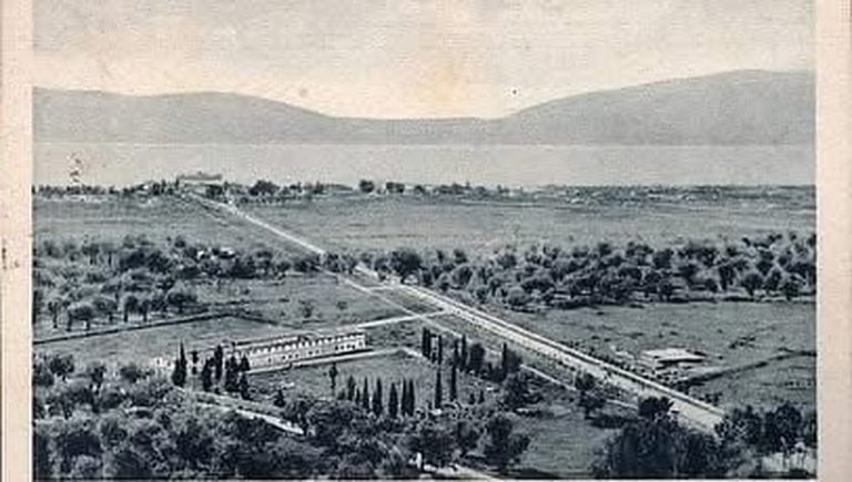
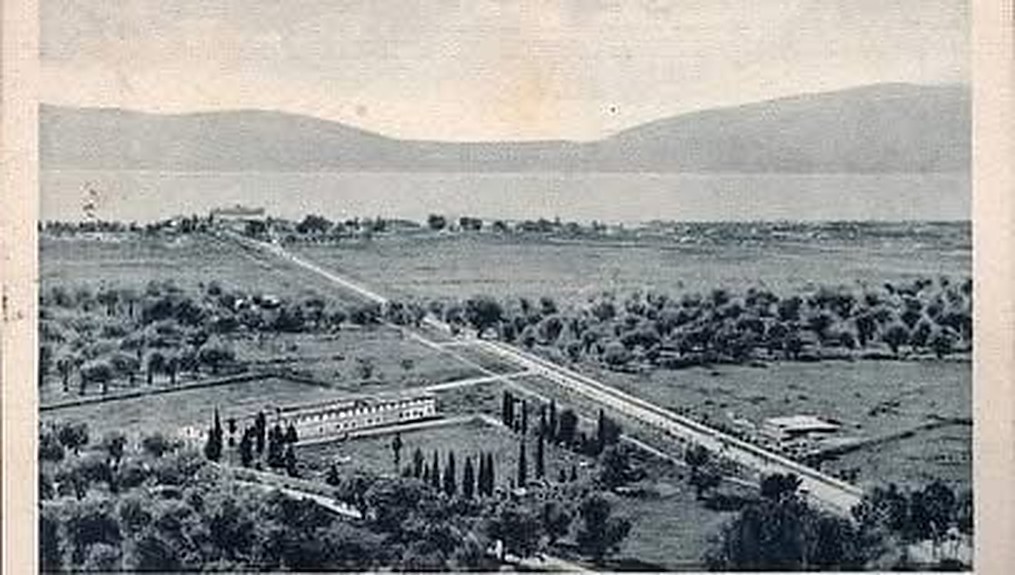
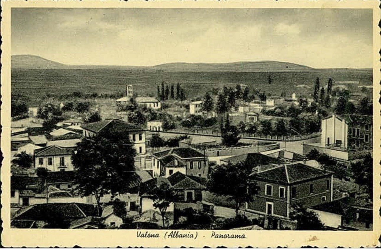
Old postcard panorama of Vlorë with low houses, cypresses and the open plain behind

Yes, Italy once drew a completely new Vlorë, and almost none of it was built. In 1939–40 the architect Gherardo Bosio and his office planned a cathedral square, a palace for the armed forces, an airport and a new town reaching down to the sea. On the plan, the coast road runs off the page towards one word, Krionero: today’s Uji i Ftohtë, where Valza Boutique Hotel stands.

On 31 May 1940 a photographer of the Istituto LUCE in Rome set up his camera in front of a few large sheets of paper. They showed a town that did not exist yet: wide new streets, a square with a bell tower, a quarter for airmen, a road along the sea. The town was Vlorë. Within a year the architect who drew it was dead, Italy was losing a war it had started from Albanian soil, and the sheets went into a drawer.

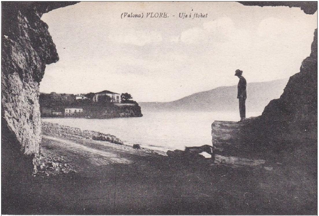
Most visitors walk through Vlorë without knowing any of this. Yet the plan explains a great deal of what you see: why the old town sits so far from the sea, why a long straight road runs down to the port, why an Italian palazzo is the town hall, and why, in old postcards, the place where our hotel stands has a different name. This is the story of the Vlorë that Italy wanted, the Vlorë it actually left behind, and the walk you can still take from one to the other.

The lost plan for Vlora at a glance

What it is
The town plan (piano regolatore) for Vlorë drawn in 1939–40 by the office of Gherardo Bosio, head of Italian town planning in Albania. It was never carried out.
Where
The whole town: the old centre, the plain down to the port of Skelë, and the coast road to Krionero, today Uji i Ftohtë.
Time needed
About 1 h 45 on foot for the 7.5 km walk from Flag Square to Valza Boutique Hotel, or a relaxed morning with stops.
Best time
Spring and autumn mornings, when the light is soft on the old façades and the Lungomare is cool.
Cost
Free: the squares, streets and seafront are open to everyone.
Good for
Anyone who likes architecture, old maps and old postcards, and wants to see Vlorë with different eyes.

Seven things most visitors never hear

Before the full story, here are the facts that surprise our guests most when we tell them at the reception desk.

The plan ends at our door. On the traffic sheet of the 1940 plan, the coast road leaves the drawing with an arrow and a single word: Krionero.

Krionero is Greek for cold water. In those years the whole quarter was called Krionero, the Greek name for the cold springs that rise here. After the liberation of 1944 only the Albanian name was used: Uji i Ftohtë, which means exactly the same thing.

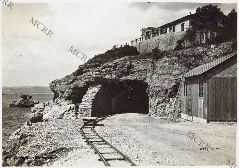
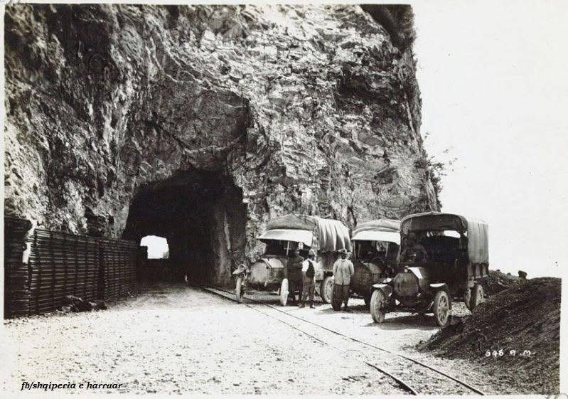
The tunnel near our hotel was cut by the Italian army. Photographs from the First World War show soldiers, a narrow-gauge railway and military lorries at the mouth of the rock tunnel of Uji i Ftohtë.

Vlorë was meant to have a cathedral square. Bosio drew it with arcades, a bell tower and a long colonnaded building. It was never built.

The plan included an airport. The zoning sheet marks an Aeroporto and a whole aviation quarter at the edge of the town.

The town hall of Vlorë was the Italian consulate. The elegant palazzo on the main square was built as the Royal Italian Consulate.

Mussolini’s daughter was shipwrecked in the bay. In March 1941 Edda Ciano was serving as a Red Cross nurse on the hospital ship Po when British aircraft sank it at Vlorë. She survived.

Two towns and a road: Vlora before the Italians

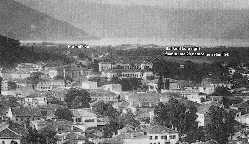
To understand the plan, you first have to understand the odd shape of old Vlorë. For centuries it was not one town but two. The town itself, with its bazaar, mosques and houses, sat inland on the lower slopes of the hills, safe from the sea, from malaria and from pirates. The port, Skelë, lay about two kilometres away on the shore, a small cluster of customs houses, warehouses and quays. Between them stretched a flat, empty plain of olive groves and fields.

A single road joined the two. It is the road you still drive today from the centre down to the port, and in the old photographs it looks almost unreal: a straight line of trees running across open country to the bay, with hardly a building on either side.

That empty plain is the key to everything that follows. Every planner who came to Vlorë in the twentieth century looked at it and saw the same opportunity: to join the town to its sea, and to turn an inland market town into a port city.

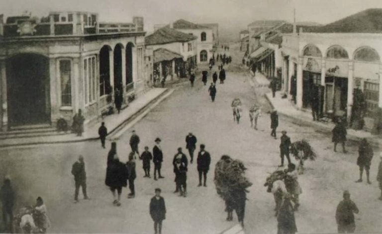
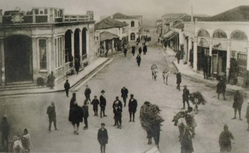
The town itself was lively but small. Its main street was lined with low arcaded shops, and on market days the road filled with people, mules and loads of firewood brought down from the villages.

In November 1912 this small town became the birthplace of the Albanian state, when Ismail Qemali declared independence here. Two years later, the first Italian soldiers arrived.

1914–1920: how did the Italian army change Vlora?

It turned the bay into a fortress, and built the first modern roads around it. The reason was geography. The Bay of Vlora faces the Strait of Otranto, the narrow gate of the Adriatic, and Italy is only about 70 km away across the water. Whoever held the bay could close the Adriatic.

Italian troops occupied Sazan Island in October 1914 and landed in Vlorë at the end of December 1914. For the rest of the First World War the town was the heart of an Italian entrenched camp, the Campo trincerato di Valona. The army needed to move men, guns and supplies quickly, so it built what the town had never had: proper roads, quays, barracks, depots, a military airfield, and narrow-gauge railways that carried stone and supplies along the coast.
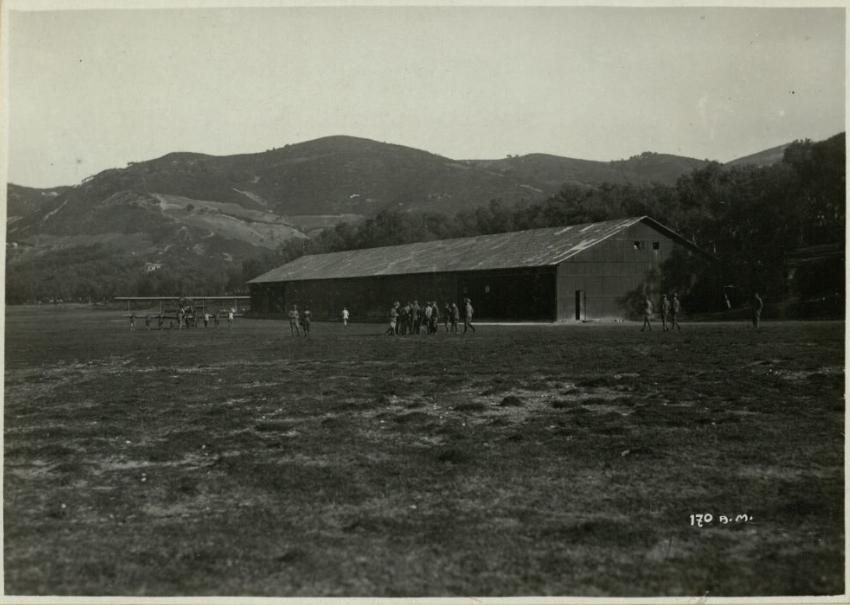
Italian military airfield hangar near Vlorë in 1916

The airfield built by the Italian army at Vlorë in 1916. Photo: Arkiva Digjitale Shqiptare, collection of Ilir Balili.

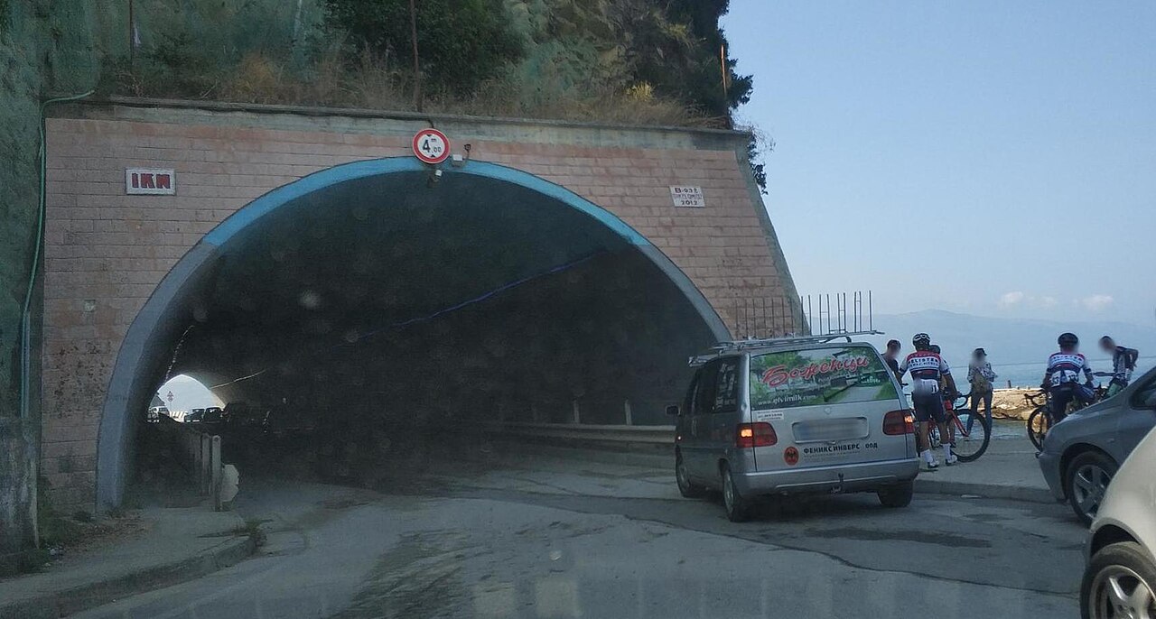
One of those works is a few minutes’ walk from our hotel. South of the port, the coast at Krionero ends in a rocky headland that drops straight into the sea. To carry the road and the little railway around it, the Italian army cut a tunnel through the rock. Photographs from the archive of the Museo Centrale del Risorgimento in Rome show the work: rails laid on the gravel, a wooden hut, a villa already standing on the cliff above, and the dark mouth of the tunnel.

A second photograph from the same series shows military lorries parked at the entrance, their canvas roofs rolled down, while soldiers stand beside the rails: the first traffic jam in the history of Uji i Ftohtë. By 1932 the tunnel was already framing postcards of the bay, and it is still in use today, with a brick face and a modern arch, but cut through the same rock.

The occupation ended in 1920. That summer the people of Vlorë and the villages around it rose against the Italian garrison in what Albanians call the Vlora War, and in September the Italian troops sailed home. Italy kept only Sazan. But the roads, the quays and the tunnel stayed, and so did the name the Italians used for the cold springs: Krionero.

Between the wars: Italian money, an Albanian town

When Italy came back, it came with money rather than soldiers. In 1925 Italian capital founded the Society for the Economic Development of Albania (SVEA), which financed public works across the country. According to the historian Ariola Prifti, among the first works to be built were the ports of Vlorë and Durrës, designed by the engineer Luigi Luiggi, who had also built the ports of Massawa and Tripoli. New roads followed, including the road from Durrës to Vlorë, and from the 1930s the Italian oil company AGIP worked the oil fields around Vlorë.

The town was changing from the inside too. In 1925 the great saraj of the Vlora family was pulled down. According to the archive’s caption, it was from this house that the flag of independence had been raised in 1912. In its place came a public garden beside what is now Flag Square.

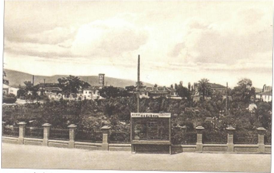
By 1939 the garden had grown into the green heart of the town, fenced with stone pillars and shaded by palms.

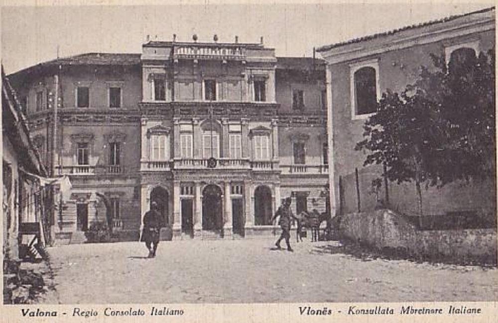
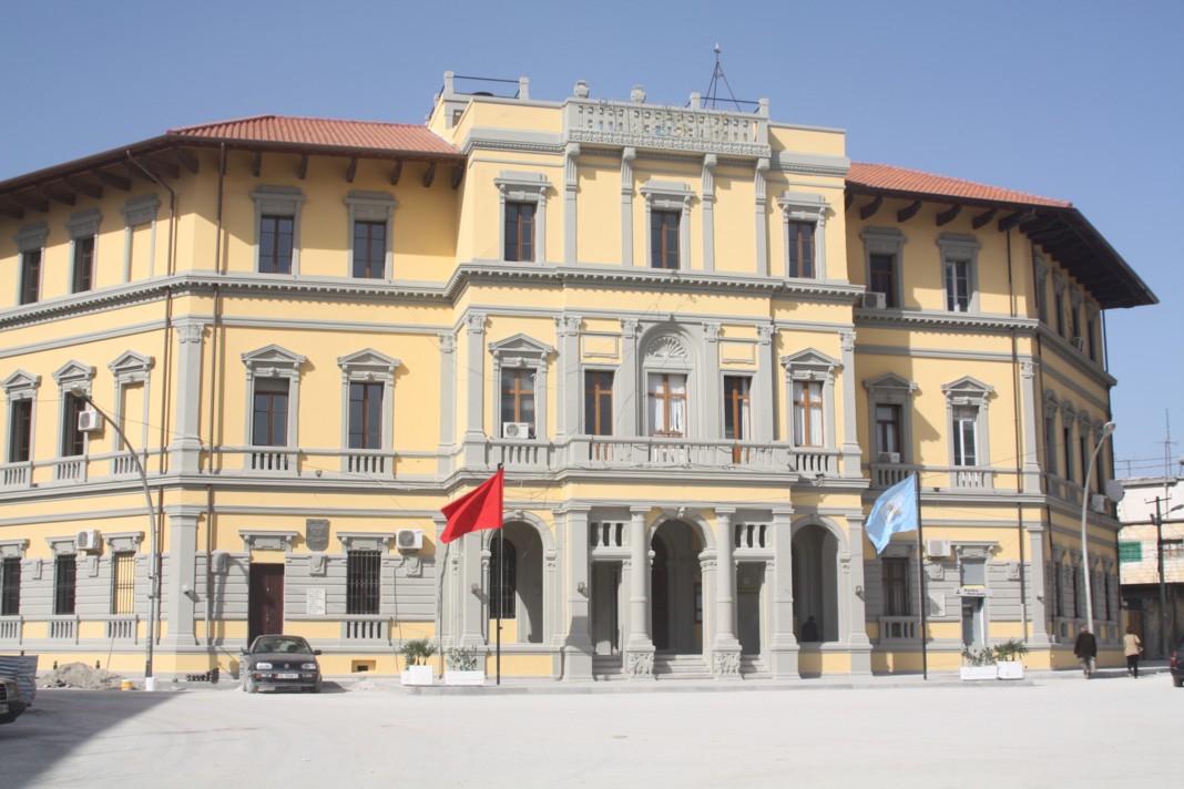
The most elegant building in town was not Albanian at all. The Royal Italian Consulate, a palazzo with arched windows on the main square, is today the town hall of Vlorë. In the postcards of the late 1930s, Vlorë still looks like a large village: tiled roofs, gardens, cypresses, a few new two-storey houses, and behind them the empty plain running towards the hills.

Almost nothing has changed on the façade: the same arched doorway, the same balconies, the same rhythm of windows. Only the flags at the door have changed.

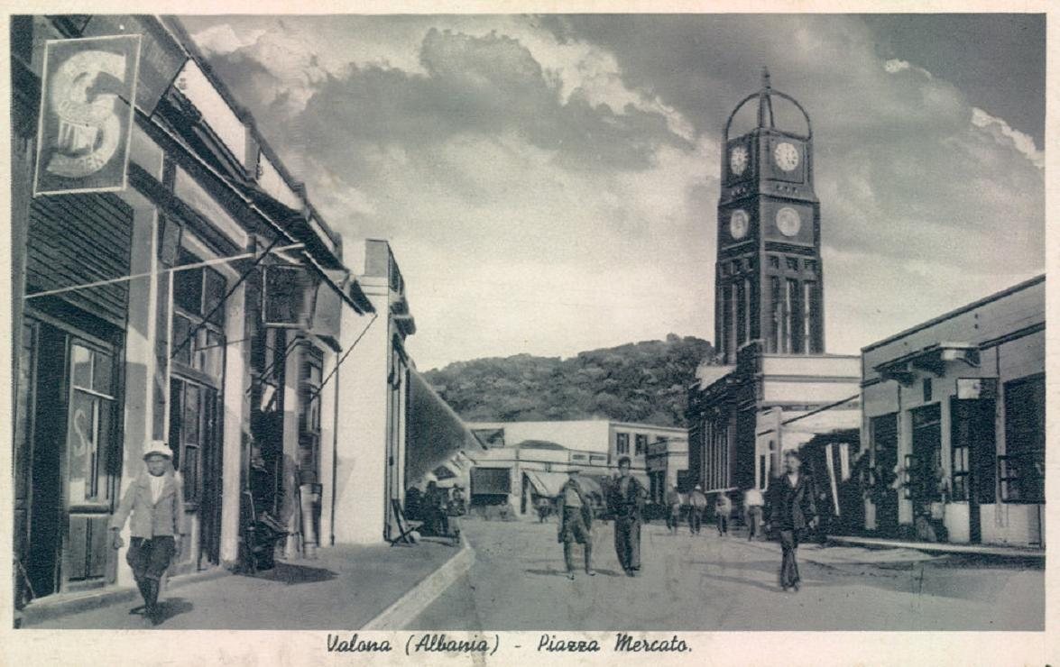
Look again at the postcard at the top of this page. This is the town the planners of 1940 had in front of them: low, green and still turned away from the sea.

  • 1:2000 scale

    The scale of the zoning sheet of the 1940 plan for Vlorë

  • 3 town plans

    Tirana, Vlorë and Elbasan, all drawn by Bosio’s office

  • 31 May 1940

    The day LUCE photographed the drawings of the plan

  • 2 years

    All the time Bosio had in Albania, from 1939 to his death in 1941

1939–1940: what did the Italian plan for Vlora look like?

A new, monumental town that finally faced the sea. On 7 April 1939 Italian troops invaded Albania. That summer the Florentine architect Gherardo Bosio, then 36, arrived in Tirana as director of the new Central Office for Building and Town Planning of Albania. He had already drawn town plans for Italian East Africa. According to the architect Paolo Di Nardo, under Bosio’s direction the office produced the town plans of Tirana, Vlorë and Elbasan, and preliminary studies for the other main towns, in barely two years.

For Vlorë, the planners took up the old opportunity of the empty plain. The studies of Pallini and Scaccabarozzi describe the idea: the town would grow towards the port along a civic axis running down to the sea, with tourism along the coast. In other words, Vlorë would stop being a market town with a harbour two kilometres away, and become a city on its bay.

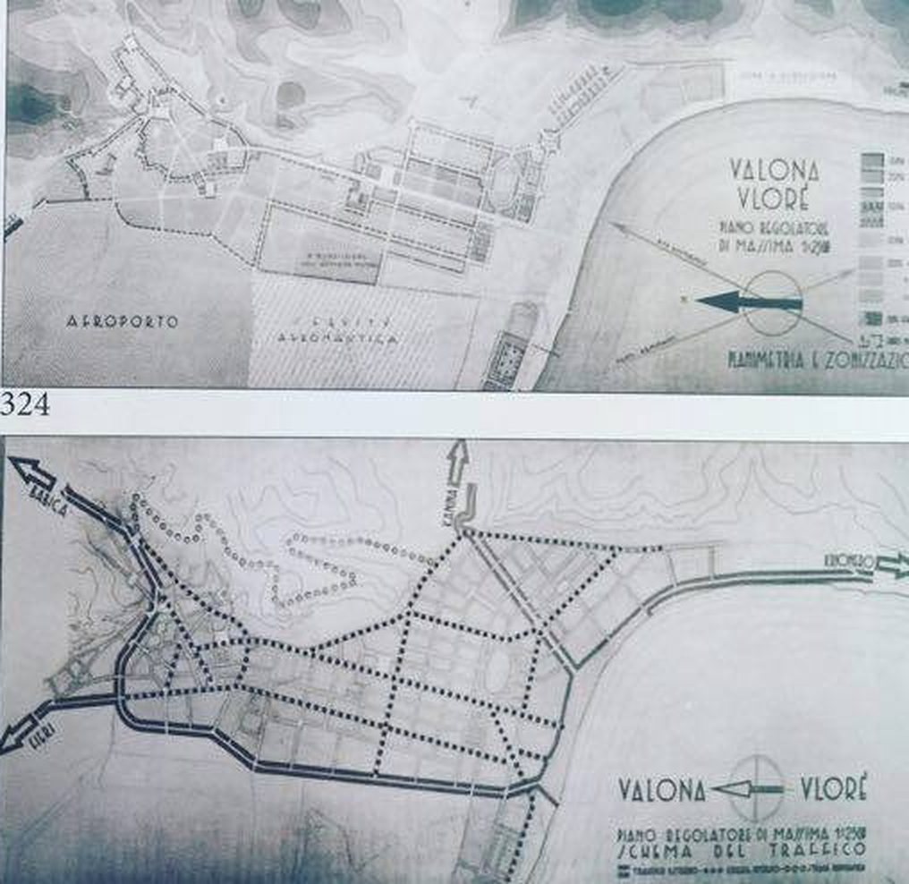
The sheets for Vlorë, reproduced in later studies and kept in the Albanian archives, show four things.

  • A zoning plan at 1:2000, dividing the town into areas for houses, offices, the port and green space.
  • A cathedral square with arcades, a tall bell tower and a civic building, and next to it a Palace of the Armed Forces.
  • An airport and an aviation quarter (Città Aeronautica) on the flat land at the edge of town.
  • A traffic scheme of new streets crossing the old town, and a coast road along the bay that ends in an arrow marked Krionero.

One sheet even proposes a new layout for the garden of Ismail Kemal, the Italian spelling of Ismail Qemali. The founder of the Albanian state was to have a garden in a town redrawn by the country that now occupied it, a contradiction the drawings do not seem to notice.


1940 Italian town plan of Vlorë, zoning sheet and traffic scheme with the coast road arrow marked Krionero

Two sheets of the 1940 plan: the zoning plan with the airport (top) and the traffic scheme, with the coast road leaving the drawing towards Krionero (bottom right). Photo: Arkiva Digjitale Shqiptare, collection of Ilir Balili.

Look at the bottom right corner of the traffic scheme. The coast road follows the bay south, past the port, and then simply leaves the paper. The planners did not draw what lay beyond. They only wrote where the road was going: Krionero.

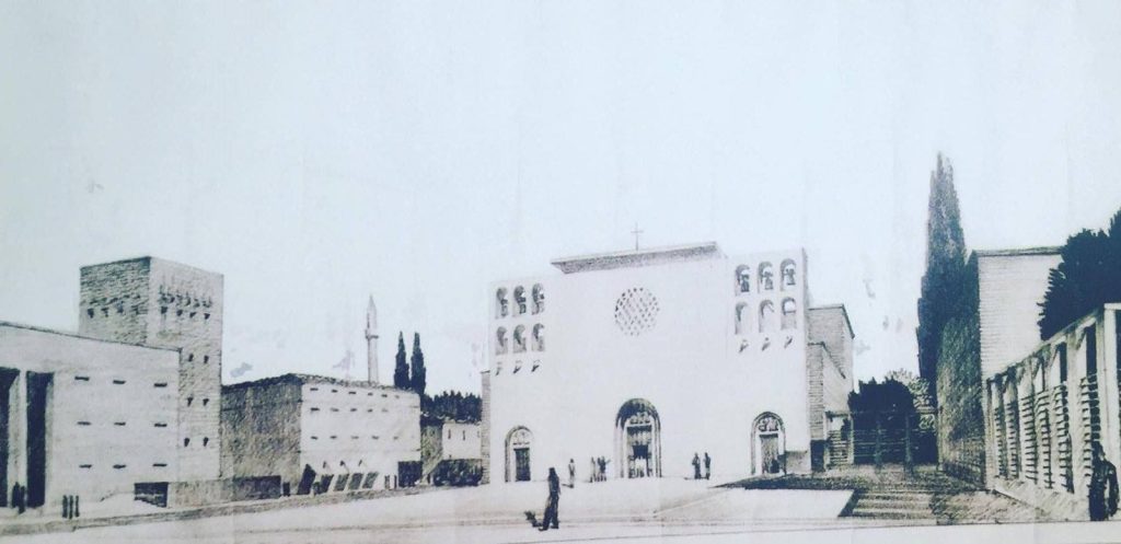
The cathedral square that never was

The most striking drawing is the Piazza della Cattedrale. Bosio imagined a wide paved square closed by a church with a rose window, a square tower and a long colonnaded building, all in the pale, stripped-down classical style he also used in Tirana. The archive caption places this new centre near the old rice factory, on the plain between the old town and the sea.


Drawing of the planned cathedral square of Vlorë by Gherardo Bosio, 1939–40, never built

Gherardo Bosio’s Piazza della Cattedrale for Vlorë, 1939–40. The original drawing is kept in Tirana at the Central Technical Archive of Construction (AQTN). Photo: Arkiva Digjitale Shqiptare, collection of Ilir Balili.

It was never built: published reproductions of the drawing label it progetto non realizzato, a project not carried out. When we look at it today, the strangest thing is how calm it is: a quiet, sunny square with a few small figures crossing it, drawn at the very moment the bay below was filling with warships.

1940–1941: why was the plan never built?

Because the war arrived first. On 28 October 1940 Italy attacked Greece from Albania, and Vlorë became one of the main ports for the front. Troops, mules and supplies came in through the bay; the wounded went out. Archive photographs date a military field hospital at Krionero to 7 November 1940, and another stood under the old plane tree by the springs.

The war came to the bay itself. Archive photographs record British bombers over Vlorë on 11 January 1941. On the night of 14 March 1941 British torpedo aircraft sank the Italian hospital ship Po at anchor in the bay. On board, serving as a Red Cross nurse, was Edda Ciano, the daughter of Mussolini; she reached the shore alive. The wreck still lies on the bottom of the bay, and divers visit it today.

A month later, on 16 April 1941, Gherardo Bosio died in Florence, after a year of illness. He was 38. The work in Tirana was carried on by other architects, but there was no money, no time and no will for monuments in a small port at war. In September 1943 Italy left the war, and in November 1944 Albania was liberated. The new state had its own ideas about how Vlorë should grow, and the 1940 sheets went into the archives.

With the plan went the name. In the years of the plan the quarter south of the port was still Krionero. After the liberation only the Albanian name was used, and today no one in Vlorë calls it anything but Uji i Ftohtë.

What was built, and what was not?

The honest answer is that Vlorë kept the Italian works of the years before the plan, and lost the plan itself.

There before the plan, and still there

The Royal Italian Consulate, today the town hall; the public garden by Flag Square; the port at Skelë and the road to Durrës; the coast road and its tunnel at Uji i Ftohtë.

Drawn but never built

The cathedral square and its bell tower; the Palace of the Armed Forces; the airport and aviation quarter of the plan; most of the new streets cut through the old town. Even Via Vittorio Emanuele III lost its name: today it is Rruga Perlat Rexhepi.

The plain between the town and the sea did fill up in the end, but decades later, with the blocks of the socialist years and the hotels and apartments that came after 1991, built by other hands and in another style.

Krionero: where the plan runs off the page

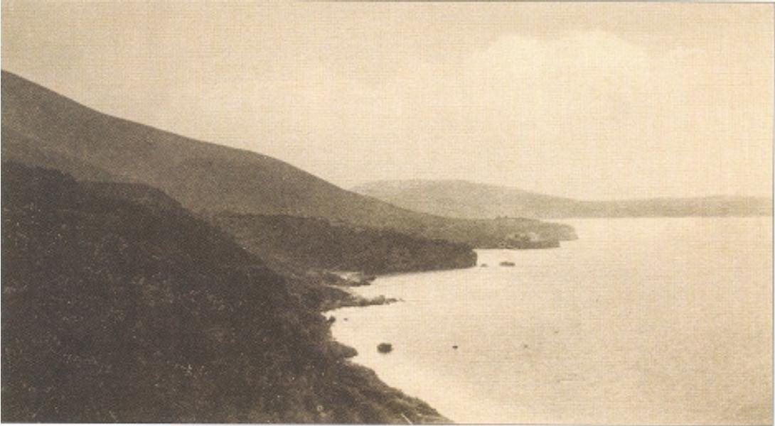
For the Italian planners, Krionero was the edge of Vlorë. For us it is home, so we went looking for what it looked like when Bosio’s office drew that arrow. The answer, in the old photographs, is: almost nothing. In 1916 the coast south of the port was empty, a line of scrub and rock above the water.

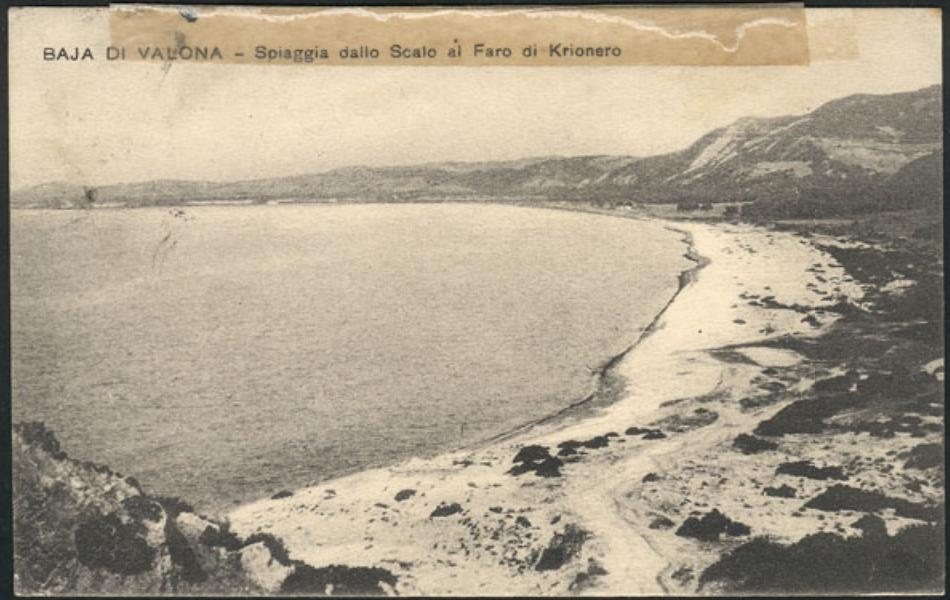
An Italian postcard of the same year shows the long white beach from the port to the Krionero lighthouse, with the hills of the Riviera behind. Its caption reads “Baja di Valona, spiaggia dallo Scalo al Faro di Krionero”: the beach from the port to the lighthouse of Krionero.

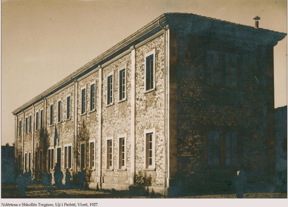
Slowly, the road brought people. Already in 1927 a large stone building stood here: the Commercial School of Vlorë.

The school shows that Krionero was no longer just a road and a spring. It was becoming a quarter of the town, the first place where Vlorë reached along its own coast.

On summer mornings the old army tunnel fills with cars, scooters and cyclists heading for the beaches.

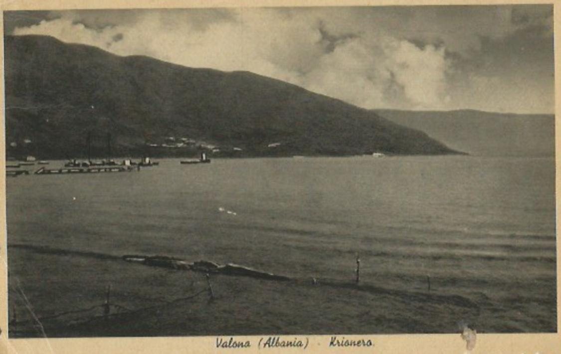
By 1940 Krionero had postcards of its own, and the planners in Tirana had given it a place on their map, as the point where the new city’s coast road would lead. The springs, the tunnel and the view of Sazan and Karaburun are exactly where they were.

Walk the plan: from the 1940 centre to Krionero

The map below, drawn by us, follows the places in this story from the old centre to the end of the 1940 drawing. It is about 7.5 km and 1 h 45 on foot from Flag Square to Valza Boutique Hotel. If your legs give up halfway, city bus 2A runs along the Lungomare to Uji i Ftohtë about every 20 minutes; our guide on how to get to Vlorë and around it has the full bus map.

Walk the 1940 plan of Vlorë: from the town centre to Krionero and Valza Boutique HotelSchematic walking map of Vlorë, not to scale. Eight numbered stops follow the places in the story of the Italian town plan of 1940: the clock tower and the former Piazza Mercato, Flag Square and the public garden that replaced the Vlora family saraj, the town hall that was the Royal Italian Consulate, Muradie Mosque and the old town, the road from the centre down to the port of Skelë, the Lungomare, the tunnel and springs of Uji i Ftohtë, which the Italian planners called Krionero, and Valza Boutique Hotel between the Villas and Castle bus stops. A green arrow repeats the word Krionero that ends the traffic scheme of the 1940 plan.KUSHTRIMIMURADIE1 MAJILUNGOMAREUJI I FTOHTËBay of Vlorë1940 plan:the city growstowards the portKRIONEROthe last word of the 1940 planClock tower, former Piazza Mercato1Flag Square and the public garden2Town hall, once the Italian consulate3Muradie Mosque and the old town4Skelë: the port and the museum5Lungomare seafront6Uji i Ftohtë tunnel and springs7Valza Boutique Hotel8Walk the planAbout 7.5 km, 1 h 45 on foot · bus 2A back1Clock tower, former Piazza Mercato2Flag Square and the public garden3Town hall, once the Italian consulate4Muradie Mosque and the old town5Skelë: the port and the museum6Lungomare seafront7Uji i Ftohtë tunnel and springs8Valza Boutique HotelSKELËFrom the 1940 centre to KrioneroSchematic walking map, not to scaleDrawn by Valza Boutique Hotel · plan details from the 1940 drawings

The green arrow is the one on the 1940 plan. The red dots are your walk. The two meet at stop 7, at the tunnel the Italian army cut.

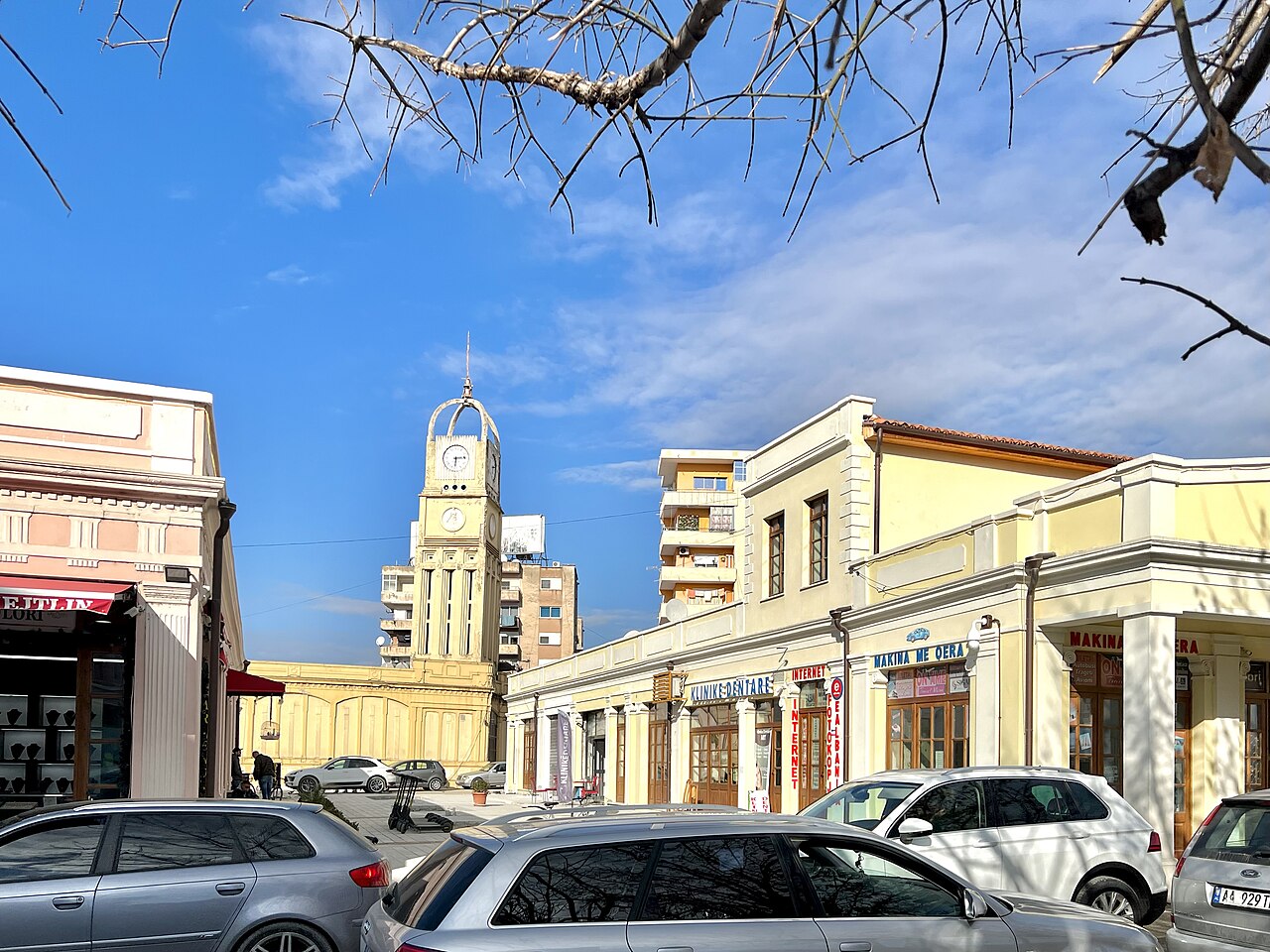
The market square has changed beyond recognition, but the tower is still there, and it is the easiest place to start the walk.

1–3 · The 1930s centre

Start at the clock tower, where the Italians’ Piazza Mercato stood, then cross Flag Square and the Independence Monument, on the ground of the vanished saraj and its garden. The town hall on the square is the former Italian consulate.

4 · The town the plan would have changed

Walk past the Muradie Mosque into the lanes of the old town of Vlorë: this is the fabric the new streets of 1940 were drawn straight through.

5 · Down to Skelë

Follow the old road from the centre down to the port, across the plain the plan wanted to fill. At Skelë, the National Museum of Independence keeps the story of 1912.

6–8 · The road to Krionero

Walk the Lungomare south along the bay to the tunnel and the springs of Uji i Ftohtë, where the 1940 drawing runs out, and finish at Valza Boutique Hotel.

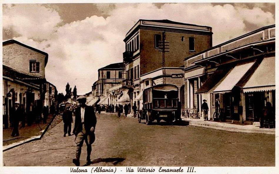
On the way, look for the street that the Italians named after their king. In 1939 it was Via Vittorio Emanuele III, full of shop awnings and the town’s first lorries. Today it is Rruga Perlat Rexhepi.


Postcard of Via Vittorio Emanuele III in Vlorë, 1939

Via Vittorio Emanuele III in 1939, today Rruga Perlat Rexhepi. Photo: Arkiva Digjitale Shqiptare, collection of Ilir Balili.

Why does an unbuilt plan matter to a visitor?

Because it explains the town you walk through. The old town sits inland because Vlorë grew up away from the sea, and the long road to Skelë is the old link between the two. The plan of 1940 is the moment when someone tried to pull the town and its port together into one city facing the bay, and failed. Today’s Vlorë, with its seafront and its new quarters on the plain, finished that job in its own way.

Standing at the tunnel of Uji i Ftohtë, knowing that in 1940 this was where the map of the new Vlorë simply ended, changes the view.

If you would like to stay at the end of the drawing, see our rooms and suites, end the walk with dinner at Eden by Valza, our rooftop above the bay, or contact our reception team, who are happy to help you plan the day.

Go deeper

Frequently asked questions about the Italian plan for Vlora


Did Italy build Vlorë?

Not as a whole. Between 1914 and 1943 Italy built roads, quays, the port, an airfield, the tunnel at Uji i Ftohtë and some important buildings in Vlorë, including the Royal Italian Consulate that is now the town hall. The full town plan of 1939–40, with its cathedral square, armed forces palace and airport, was never carried out.


Who designed the Italian town plan of Vlorë?

The office of the Florentine architect Gherardo Bosio, director of the Central Office for Building and Town Planning of Albania from 1939. His office drew the town plans of Tirana, Vlorë and Elbasan. Bosio died in Florence on 16 April 1941, before any of the plan for Vlorë could be built.


Why was Uji i Ftohtë called Krionero?

Krionero comes from the Greek for cold water, after the springs that rise there. It was the name of the quarter in the Italian years, used on maps, postcards and the 1940 plan. After the liberation of 1944 only the Albanian name Uji i Ftohtë, which means the same thing, was used.


Who built the tunnel at Uji i Ftohtë?

The Italian army, during the First World War, to carry the coast road and a narrow-gauge railway around the rocky headland south of the port. Wartime photographs show soldiers, rails and military lorries at its entrance. The tunnel is a few minutes’ walk from Valza Boutique Hotel.


Where can I see the drawings of the 1940 plan?

The original drawings are kept in Tirana, in the Central Technical Archive of Construction (AQTN), and reproductions appear in studies of Italian architecture in Albania. Photographs of them taken by the Istituto LUCE on 31 May 1940 are listed in the photographic archive of the Italian Ministry of Foreign Affairs. Many related photographs are online in the Albanian Digital Archive.


Can I walk from the centre of Vlorë to Uji i Ftohtë?

Yes. From Flag Square to Valza Boutique Hotel in Uji i Ftohtë it is about 7.5 km, or 1 h 45 on foot, past the old town, down to the port of Skelë and along the Lungomare. City bus 2A runs back along the seafront about every 20 minutes.


Sources

  1. Di Nardo, P. Il disegno della nuova Tirana: Gherardo Bosio. AND – Rivista di architetture, città e architetti, no. 85 — Bosio’s office, the town plans of Tirana, Vlorë and Elbasan, and his death on 16 April 1941.
  2. Ministero degli Affari Esteri e della Cooperazione Internazionale. Archivio fotografico del Sottosegretariato di Stato per gli Affari Albanesi (catalogue) — LUCE photographs nos. 2062–2064, “Progetti del Piano Regolatore di Valona e Tirana”, 31 May 1940.
  3. Prifti, A. (2013). The Realization of the “New Architecture”: the Italian colonial experience in Albania during the years 1925–1943. Academic Journal of Interdisciplinary Studies 2(9), pp. 648–656 — the ports of Vlorë and Durrës, Luigi Luiggi, the Durrës–Vlorë road, AGIP.
  4. Boriçi, O. Doctoral thesis, Faculty of Architecture and Urban Planning, Polytechnic University of Tirana — the Bosio office and its plans for Albanian towns, 1939–1943.
  5. Pallini, C. and Scaccabarozzi, A. L’urbanistica corporativa e i piani italiani per le città dell’Albania. Politecnico di Milano — the general idea of the plan for Vlorë.
  6. Vokshi, A. (2013). Tracce dell’architettura italiana in Albania, 1925–1943. Doctoral thesis, University of Florence — chapter on the town plan of Vlorë.
  7. Godoli, E. and Tramonti, U. (eds.) (2012). Architetti e ingegneri italiani in Albania. Florence: Edifir.
  8. IANTD Expeditions (2005). The hospital ship Po, sunk at Valona on 14 March 1941 — the sinking and the wreck.
  9. Arkiva Digjitale Shqiptare (ADSH), collection of Ilir Balili — the plan sheets (item 5395), the cathedral square (4693), and photographs and postcards of Vlorë and Uji i Ftohtë, 1916–1941 (items 3591, 3621, 3638, 3725, 4910, 4949, 5421, 5724, 5900, 6120, 6328, 6438, 6472).
  10. Museo Centrale del Risorgimento, Rome (MCRR) — First World War photographs of the works at the tunnel of Krionero.
  11. Arkivi Qendror Teknik i Ndërtimit (AQTN), Tirana — original drawing of the Piazza della Cattedrale, Vlorë, 1939–40.
  12. Wikimedia Commons — present-day photographs of the town hall (Idobi, CC BY 3.0), the clock tower (Sharon Hahn Darlin, CC BY 2.0) and the tunnel of Uji i Ftohtë (freddouhelk / Mapillary, CC BY-SA 4.0).